

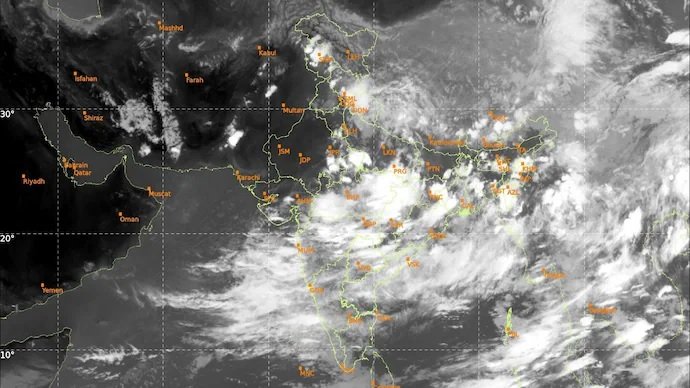
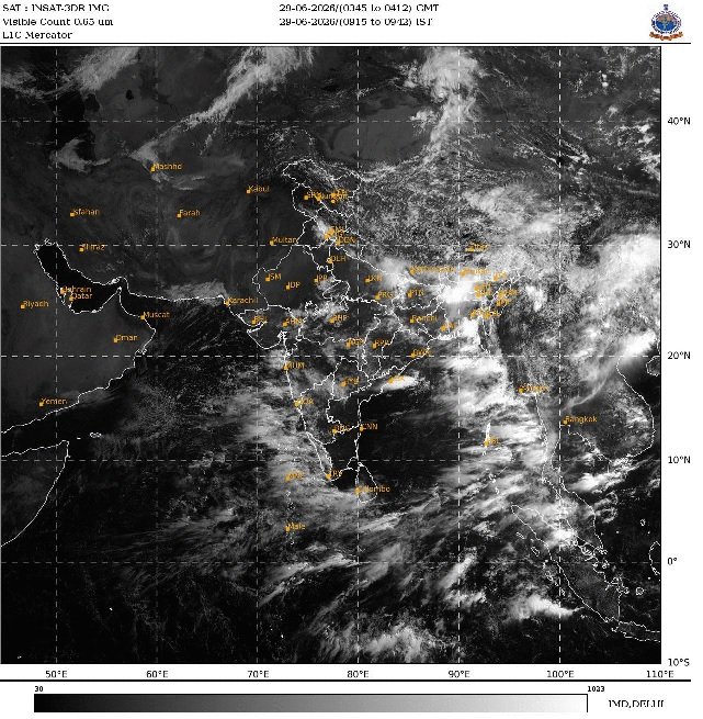
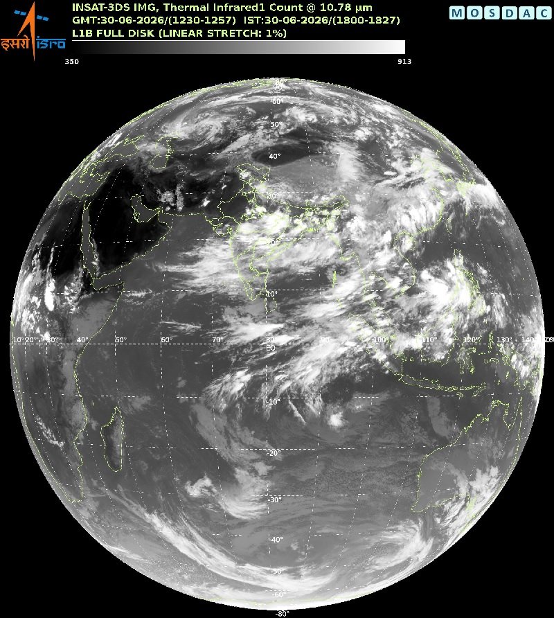
India’s stalled southwest monsoon is showing signs of life. Fresh satellite images from the Indian Space Research Organisation (ISRO) reveal dense cloud bands spreading across northern India after weeks of sluggish progress, offering relief to farmers and millions enduring an unusually dry start to the season. The development comes after India closed June with a 39.8% rainfall deficit, making it the country’s fifth-driest June since records began in 1901, according to the India Meteorological Department (IMD).
Satellite Images Show Monsoon Gaining Momentum
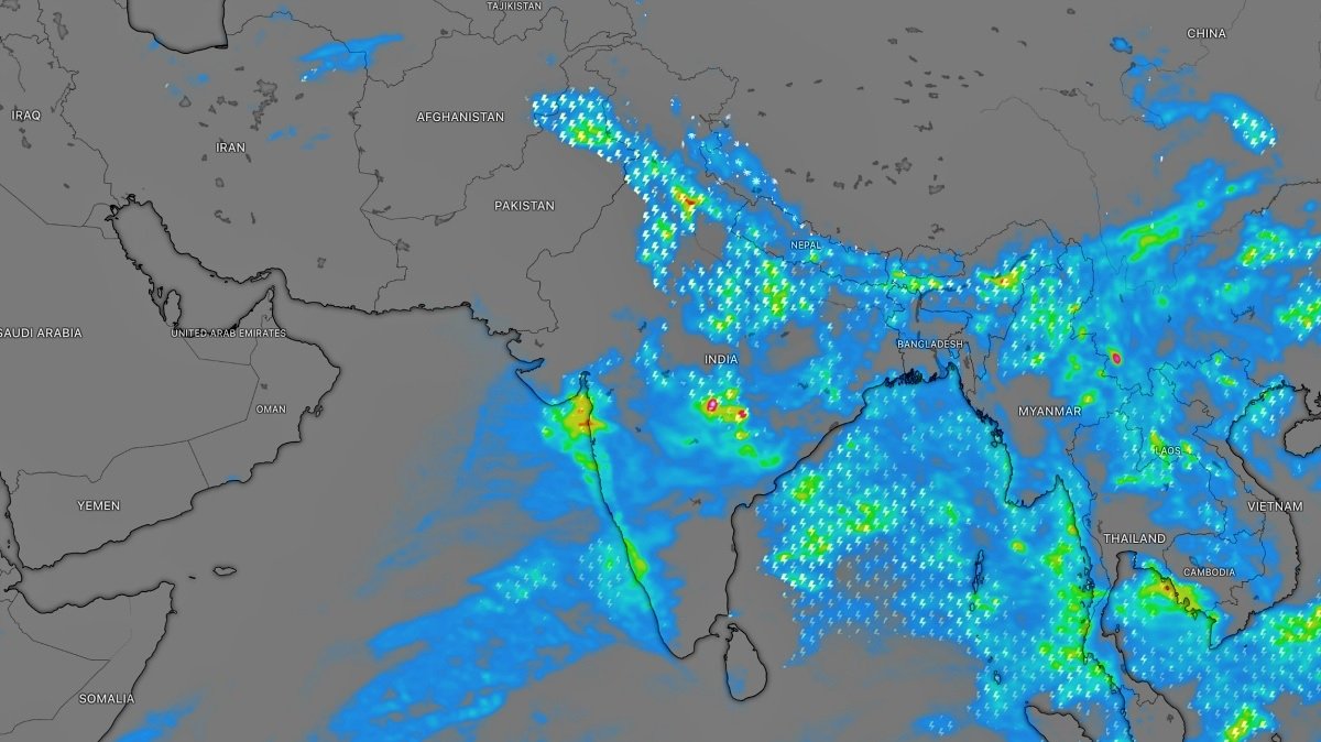
Thermal infrared imagery captured by ISRO’s INSAT-3DS satellite showed thick cloud cover stretching from central India into the Indo-Gangetic plains as moisture from the Arabian Sea and the Bay of Bengal converged over northern India. The IMD said the southwest monsoon advanced into most parts of western Uttar Pradesh and parts of eastern Haryana on July 1 following widespread rain and thunderstorms. Forecasters expect the system to move further into Delhi-NCR, Punjab, Chandigarh and additional parts of Haryana over the next 24 hours. Rajasthan, one of the states hit hardest by the delayed monsoon, remains largely outside the active rain belt, although satellite imagery suggests cloud masses are pushing steadily westward.
The delayed advance had already disrupted the kharif sowing season. India received only 99.5 mm of rainfall in June against the normal 165.3 mm, while temperatures climbed above 42°C across parts of the northern plains. Farmers have fallen behind in planting rice, cotton, corn and soybeans as inadequate soil moisture kept fields dry through much of the month.
What’s happening around the world: Ram Temple donation theft: VHP to await SIT probe on Rai
IMD Warns July May Still Finish Below Normal
Despite the dramatic improvement visible from space, weather officials remain cautious. IMD Director General Mrutyunjay Mohapatra said July rainfall is expected to remain below 94% of the Long Period Average (LPA), with the strengthening El Niño pattern likely to influence rainfall during the rest of the season. He added that if rainfall increases over the coming days, soil moisture should improve enough for farmers to accelerate sowing operations.
The monsoon delivers nearly 70% of India’s annual rainfall and supports an economy where almost half of farmland depends on rain rather than irrigation. The first half of July is now considered critical. IMD expects two low-pressure systems to strengthen monsoon circulation, helping reduce the current rainfall deficit across northern, central and western India. Even so, meteorologists caution that a few days of widespread rain will not immediately erase months of accumulated deficits or reverse delays already affecting agriculture. Meanwhile, seven of the eight northeastern states have also recorded rainfall deficiencies exceeding 40%, underscoring how uneven this year’s monsoon remains.
For more updates follow: First Report News